1. The basic trick: distance from signal travel time
0:007:24
Engineering

How Does GPS Know Exactly Where You Are?

32 satellites, atomic clocks, and Einstein's relativity — the engineering marvel in your pocket, explained from orbit to screen.

Apr 22, 20267 min listen5 chapters
What you'll learn
  • Trilateration: how three satellite signals pinpoint your location
  • Why GPS needs atomic clocks and Einstein's relativity corrections
  • The 32-satellite constellation and how it covers Earth
  • Accuracy limits, GPS spoofing, and next-gen positioning

1. The basic trick: distance from signal travel time

note

How Does GPS Know Exactly Where You Are?

32 satellites, atomic clocks, and Einstein's relativity — the engineering marvel in your pocket, explained from orbit to screen.

note

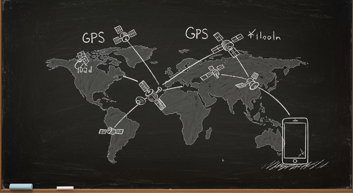
GPS trilateration: distance, not direction

GPS measures how far you are from each satellite by timing a radio signal.

A satellite at a known position gives you one possible sphere of locations. Three satellites can, in theory, narrow that to one point. In practice, the receiver clock is slightly wrong, so GPS usually needs four satellites.

Why timing matters

Radio waves travel at about 299,792 kilometers per second. A timing error of 1 microsecond creates about 300 meters of position error.

Key terms

  • Trilateration: finding position from distances
  • Satellite ephemeris: the satellite’s predicted orbit data
  • Pseudorange: the measured distance, including clock error
diagram
equation
d=c×td = c \times t
chart · bar
Timing error becomes distance error
1 ns1 µs10 µs1 ms

2. Why GPS satellites need atomic clocks and relativity

note

Atomic clocks and relativity corrections

GPS satellites carry atomic clocks because the system needs extreme timing stability.

The receiver solves for position using signal travel time, so a tiny clock drift becomes a large distance error.

Relativity in GPS

  • Special relativity: motion makes satellite clocks run slower
  • General relativity: weaker gravity at altitude makes satellite clocks run faster
  • Net effect: about 38.5 microseconds per day faster than clocks on Earth

That is large enough to cause about 10 kilometers of error per day if ignored.

equation
38.5 μs/day×299,792,458 m/s11,560 m/day38.5\ \mu s/day \times 299,792,458\ m/s \approx 11,560\ m/day
diagram
note

Real numbers that matter

  • Orbit altitude: about 20,200 kilometers
  • Orbital speed: about 3.9 kilometers per second
  • Clock error of 1 nanosecond: about 0.3 meters
  • Clock error of 1 microsecond: about 300 meters

3. The 32-satellite constellation and global coverage

note

GPS constellation coverage

The GPS system uses a constellation of satellites in medium Earth orbit.

The classic design is 24 satellites in 6 orbital planes, with additional satellites often operating as spares or active backups. In real-world operation, the constellation commonly has more than 30 healthy satellites available.

Why the geometry matters

A receiver needs several satellites spread across the sky, not clustered in one direction. Better spread means better position accuracy.

What blocks GPS signals

  • Buildings and urban canyons
  • Tree canopy
  • Mountains and cliffs
  • Indoor walls and roofs
diagram
illustration
Earth with multiple GPS satellites in six orbital planes and signal paths reaching a phone on the ground
chart · pie
Common GPS signal blockers
BuildingsTreesTerrainIndoor wallsAtmosphere and multipath

4. Why accuracy is good, and why it sometimes fails

note

What limits GPS accuracy

GPS accuracy depends on signal quality, satellite geometry, atmospheric delay, and receiver design.

Typical consumer GPS in open sky is about 3 to 5 meters. Survey-grade systems can reach centimeter-level accuracy with correction data and specialized receivers.

Common error sources

  • Ionospheric delay
  • Tropospheric delay
  • Multipath reflections
  • Satellite orbit and clock errors
  • Poor satellite geometry

Dilution of precision

DOP measures how satellite arrangement amplifies timing errors into position errors. Lower DOP means better geometry.

diagram
equation
Position errorTiming error×c\text{Position error} \approx \text{Timing error} \times c
chart · line
Typical GPS accuracy by method
Standalone GPSAugmented GPSDual frequencyRTK survey

5. Spoofing, jamming, and the next generation of positioning

note

GPS security and next-gen positioning

GPS can be jammed or spoofed because the received signals are very weak.

Threats

  • Jamming: noise blocks the real signal
  • Spoofing: fake signals imitate satellites

Defenses

  • Multi-constellation receivers using GPS, Galileo, GLONASS, and BeiDou
  • Inertial sensors and map matching
  • Dual-frequency signals like L2C and L5
  • Cross-checking position with cellular and Wi-Fi data
diagram
note

Modern positioning is layered

A phone may combine satellite data with accelerometers, gyroscopes, barometer readings, nearby cell towers, and Wi-Fi access points. That helps when satellite signals are weak or blocked.

Why this matters

Navigation is no longer just about finding a point in space. It is about estimating position continuously, even when the signal environment changes fast.

Transcript

Welcome to Slate. Today we're looking at How Does GPS Know Exactly Where You Are?. We'll cover Trilateration: how three satellite signals pinpoint your location, Why GPS needs atomic clocks and Einstein's relativity corrections, The 32-satellite constellation and how it covers Earth, and Accuracy limits, GPS spoofing, and next-gen positioning. Let's get into it.

Your phone does not ask a satellite, “Where am I?” It measures how long a radio signal took to arrive. That time tells you distance. If a signal took 0.07 seconds to reach you, it traveled about 21,000 kilometers, because radio waves move at the speed of light, about 299,792 kilometers per second. That is the core idea behind GPS: each satellite gives you one sphere of possible locations. Your location is where those spheres overlap. A good analogy is a flashlight in fog. One light gives you a glowing shell. Add more lights, and the overlap shrinks to a single spot. In three dimensions, three satellites are not enough in practice, because your phone’s clock is not perfectly synchronized with the satellites’ atomic clocks. That clock error acts like an extra unknown distance. So the receiver usually needs four satellites, not three, to solve for latitude, longitude, altitude, and clock offset together. The diagram on screen shows those intersecting distance shells. Notice the pattern: each new satellite does not just add information. It removes ambiguity. That is why GPS is called trilateration, not triangulation. Triangulation uses angles. Trilateration uses distances. Your phone is solving a geometry problem every second, quietly, while you walk, drive, or fly.

Here is the hard part: GPS only works because the clocks are absurdly good. Each satellite carries atomic clocks, usually cesium or rubidium. The system depends on nanosecond-level timing. A nanosecond is one-billionth of a second. If the clock drifts by just 10 nanoseconds, the position error is about 3 meters. That is why ordinary quartz clocks are not good enough. They wander too much. The satellite clocks are compared constantly against ground stations, then corrected. But even perfect clocks would still disagree because Einstein’s relativity changes time itself. Satellites orbit about 20,200 kilometers above Earth and move at roughly 3.9 kilometers per second. Special relativity says moving clocks run slower. General relativity says weaker gravity makes clocks run faster. For GPS satellites, the gravity effect wins. Their clocks tick faster by about 45.7 microseconds per day from altitude, while motion slows them by about 7.2 microseconds per day. Net effect: about 38.5 microseconds per day faster than clocks on Earth. That sounds tiny. It is not. If uncorrected, the error would grow to roughly 10 kilometers per day. The system is basically a race between physics and engineering, and engineering wins by baking relativity into the design before launch.

GPS is not one satellite. It is a constellation. The modern U.S. GPS system is designed around 24 operational satellites in six orbital planes, with additional satellites on orbit to improve coverage and resilience. In practice, there are often more than 30 satellites healthy and broadcasting. That is why people often describe the system as having 32 satellites in the broader operational fleet. The point is not a magic number. The point is geometry. At any moment, enough satellites must be visible above your horizon from almost anywhere on Earth. The orbits are arranged so the sky is never empty for long. Each satellite circles Earth about twice per day, with an orbital period of about 11 hours and 58 minutes. Because the Earth rotates underneath them, the pattern repeats daily, but not exactly at the same place in the sky. Here is how the coverage looks: satellites spread across multiple planes, like beads on several tilted hoops around the planet. That arrangement reduces gaps and helps receivers in cities, deserts, oceans, and mountains. But visibility still matters. Tall buildings, cliffs, dense trees, and indoor spaces block or bounce signals. GPS is strongest when the receiver can see a wide patch of sky. That is why your phone may know you are on the right street, but not the right side of the building.

A consumer GPS receiver is often accurate to about 3 to 5 meters in open sky. Under ideal conditions, with satellite-based augmentation and a good receiver, it can do much better. But raw GPS has real limits. The signal is weak by the time it reaches Earth, around minus 160 decibel-milliwatts, so interference matters. The ionosphere and troposphere slow the signal slightly. Satellites are not perfectly placed. Clock and orbit data are not perfect. And then there is multipath, where a signal bounces off a building or car before reaching your antenna. That is like hearing an echo in a canyon and mistaking it for the original shout. The receiver can also be fooled by bad geometry. If the visible satellites are bunched together in one part of the sky, small timing errors stretch into larger position errors. Engineers measure this with dilution of precision, or D-O-P. Lower is better. Modern systems fight these errors with dual-frequency receivers, correction services, and carrier-phase methods that can reach centimeter-level accuracy for surveying and robotics. But if you are standing under a bridge or in a city canyon, physics still wins some of the time. The receiver is not failing randomly. It is solving a harder problem with less clean data.

GPS is reliable, but not invincible. Jamming overwhelms the receiver with noise so it cannot hear the satellites. Spoofing is subtler. An attacker sends fake satellite-like signals that trick a receiver into believing a false location or time. Because GPS signals are weak, spoofing can work if the fake signal is stronger and well timed. That is why aviation, shipping, and critical infrastructure do not trust one source alone. They combine GPS with inertial sensors, cellular networks, Wi-Fi fingerprints, and maps. Think of it like checking a statement against several witnesses. If one witness lies, the others can expose the mismatch. New systems are also improving the signal itself. Modernized GPS uses additional civilian signals, such as L2C and L5, which improve robustness and help receivers correct ionospheric delay. Europe’s Galileo, China’s BeiDou, and Russia’s GLONASS give extra satellites in the sky, so many phones now use multiple global navigation satellite systems at once. That improves availability and accuracy, especially in cities. The future is not one perfect satellite network. It is layered positioning: satellites, sensors, maps, and network data all cross-checking each other. The result is not magic. It is redundancy. And in navigation, redundancy is what turns a clever idea into something you can trust on a rainy street with tall buildings all around.

XLinkedInWhatsApp

Keep going with Slate

Pick up where this left off in your own voice session.

Built with Slate